Maps
Maps represent geographical information. They provide location-aware context and help users understand the spatial relationship between a point, such as a site or building, and surrounding landmarks.
Usage
Interactive maps allow users to select locations, pan, and zoom to obtain further information.
Element supports two implementation options:
- Element Maps: a ready-to-use, high-level Angular component based on OpenLayers, with built-in points, grouping, clusters, labels, tooltips, and popovers.
- MapLibre: a direct integration with
@maplibre/ngx-maplibre-gl, complemented by Element control styles, theme-aware map styles, and translations.
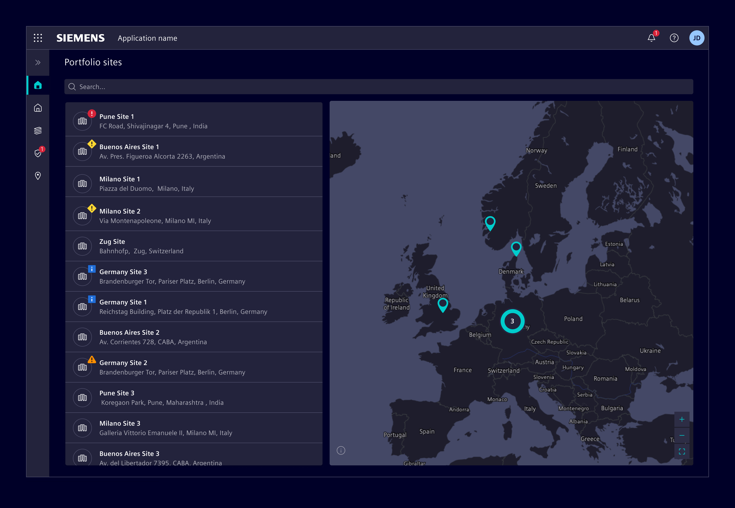
When to use
- Use it when users need to manage a large number of geographically dispersed locations.
- Use it to provide an overview of the current status of all locations.
- Use it to help users understand the surroundings of a specific location, such as a site or building.
- Maps are particularly useful for users who need to physically visit a location, such as facility managers.
Best practices
- Maps require a large amount of screen space to be readable. If space is limited, provide options to expand, collapse, or hide the map.
- If a specific location is not the focus of the displayed information, a map might not provide additional value. A textual representation of the address is more efficient.
- Limit the number of map actions, such as zoom and find my location, to five.
Design
Elements
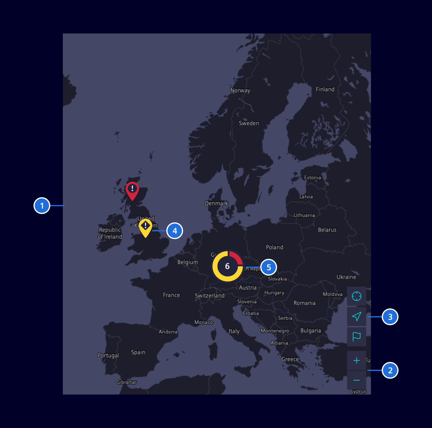
- Map, 2. Zoom actions, 3. Additional actions (optional), 4. Map pin, 5. Grouped locations
Location representation
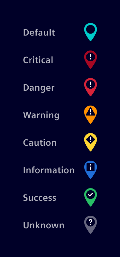
A map pin represents a single location. Map pins can also represent different statuses. Avoid mixing the status color palette with the default color.
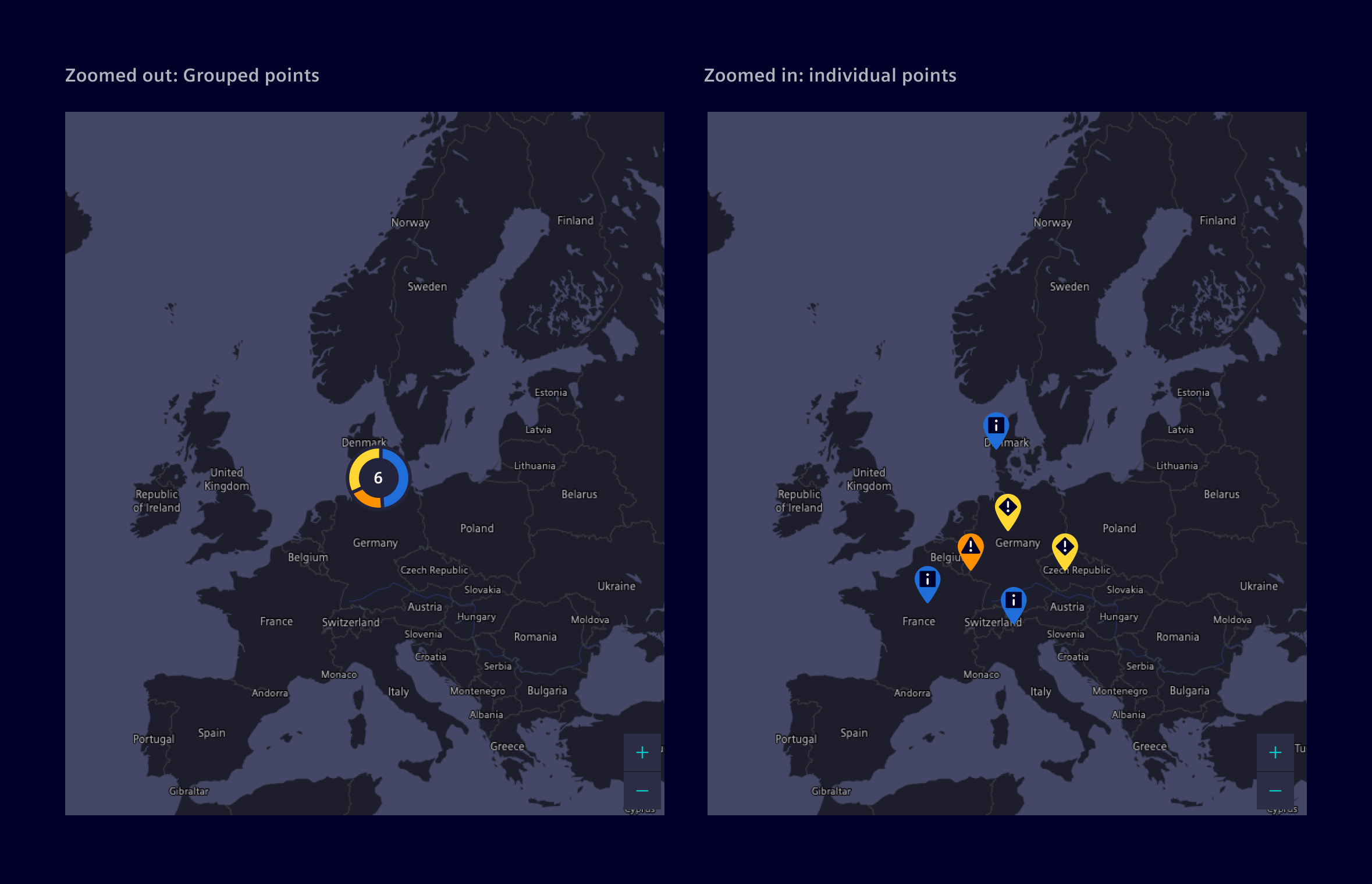
When locations are geographically close, cluster them in a donut chart to visualize their locations and statuses efficiently. When users zoom in, display the locations as individual map pins to provide a more accurate view.
The number represents the amount of locations grouped in the chart. The size of each slice indicates the relative number of locations in a specific state.
Except where otherwise noted, content on this site is licensed under MIT License.